
I live in Western Washington, basically surrounded by water on every side. Silver Lake is our local watery spot.


I really wish there were a walking path all the way around, but much of the lake shore is in private hands, so the path only goes around the east and north sides of the lake. There’s always something to see there, in every season.
Last weekend, I drove a little farther south, to visit Martha Lake Park, at the south end of another lake which the shore is mostly in private hands. There’s a short path, and some public docks and picnic tables. It was a bright, crisp winter day, with a light breeze that ruffled the water.

This is one of the two public docks where people sometimes fish. No fishermen that day. Off the left side of the dock, I peered over the railing, watching the reflections of the trees in the moving water. This photo has so many separate elements that make it a complete picture. There are spots where there is no reflection, and you can see down into the water.
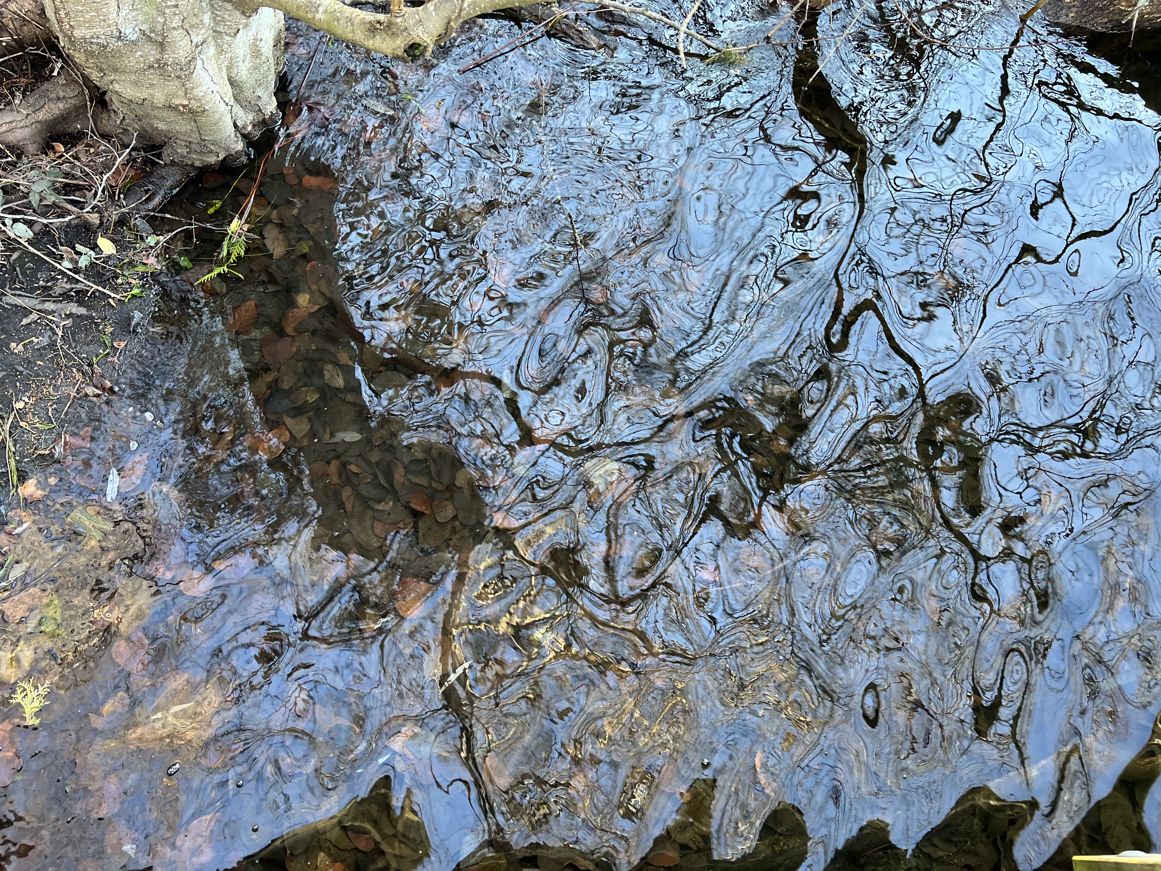
Next to the tree trunk in the upper left corner, you can see the leaves and rocks under the water. Looking at all the trees and plants along the shore, it appeared to me that the level of the lake had risen, but I don’t know how long ago it was. The water is full of what look like “drowned” trees. Off the right side of the dock, I saw what must have been a part of a drowned tree.

That one branch sticking out of the water looked so forlorn.
Of course, to the west is Puget Sound, with all its public parks, docks, and ferry terminals. We often take the Edmonds Ferry over to the Kitsap Peninsula, on our way to the Olympic Peninsula.
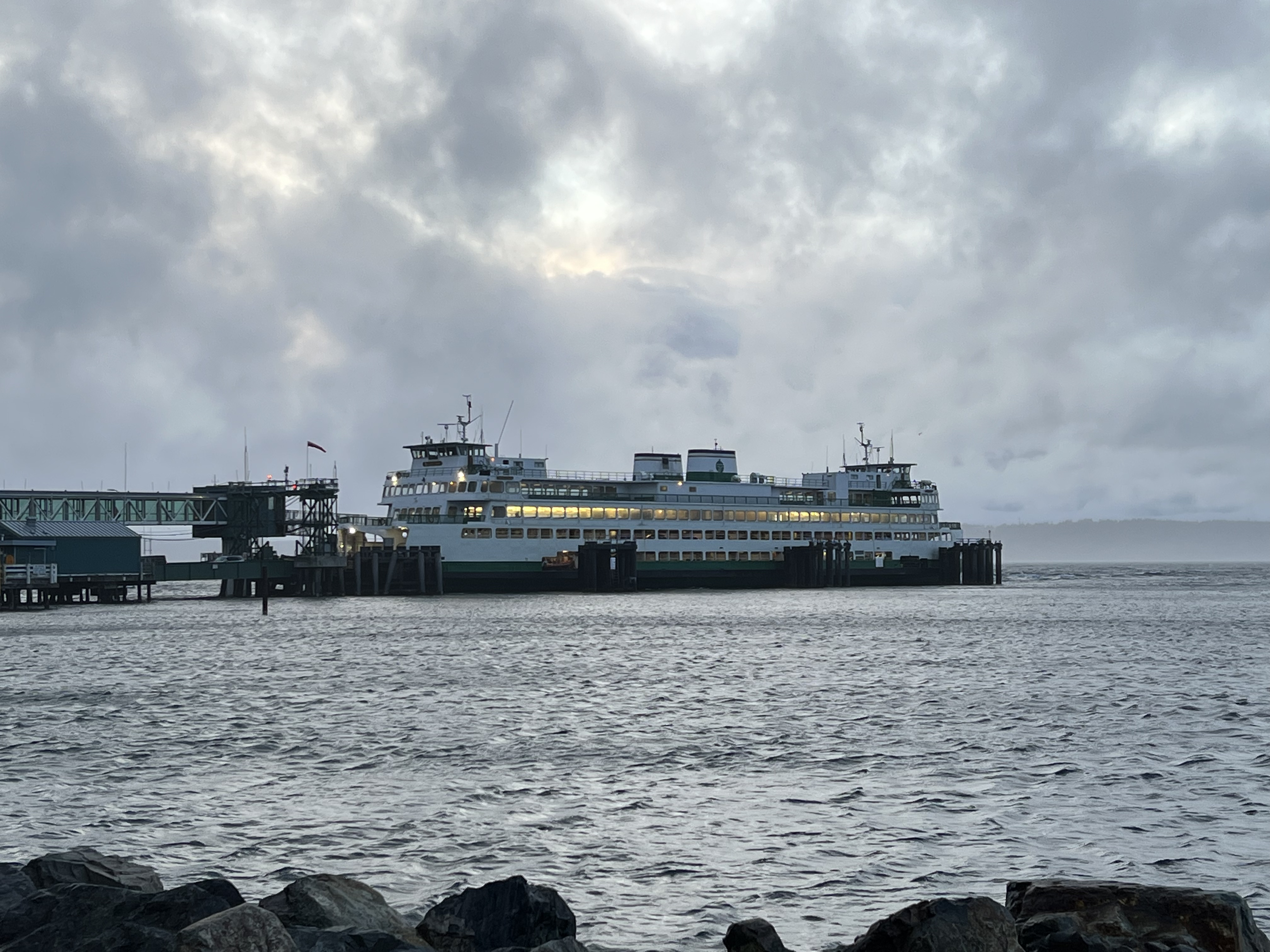
One recent blustery day, I watched how the wind created whitecaps and waves on the Sound. (and it occurred to me, too, that this photo has literally water on all sides-the clouds are water, too)
In the summer, we went to Picnic Point Park, south of Edmonds.


Picnic Point Creek flows into the Sound here, and the kids were having fun using rocks to build a little dam (not very effective).
At the north end of Puget Sound is Deception Pass, where we spent a pleasant afternoon at the state park there. The Pass itself is a treacherous stream of water, with powerful currents that can wreak havoc with unaware boaters.
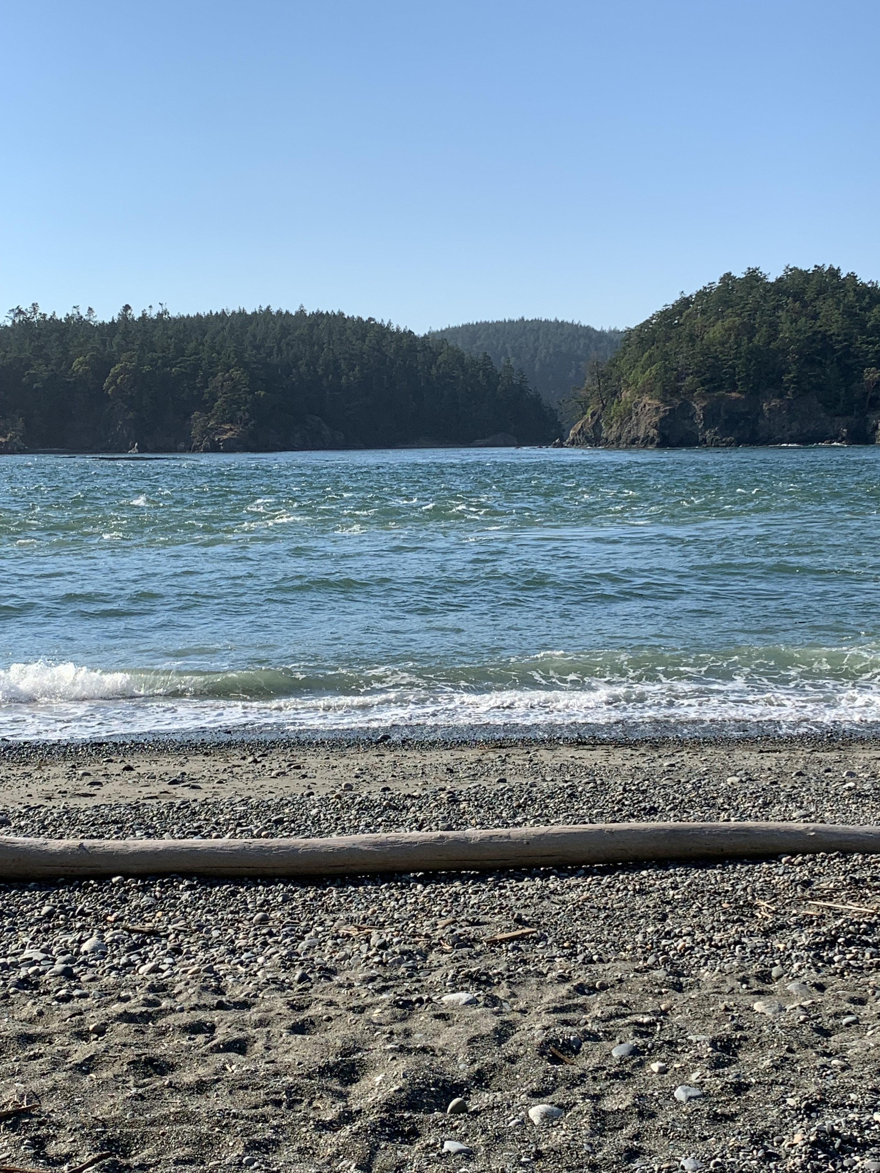
The swift current in the middle of the strait is easily visible from shore-the waters are very turbulent.
I think this picture I took years ago from the Edmonds Ferry is my best one of Puget Sound, looking south to Seattle and Mount Rainier. Tourists look for this kind of view!

The mountain looks like it’s floating in the air, doesn’t it? Right at the water’s edge, you can see the Elliott Bay Marina, with its hundreds of pleasure boats moored.
On the North Olympic Peninsula is the Dungeness Spit National Wildlife Refuge, where we like to visit at least once a year. The beach is beautiful in all weathers, and the intrepid can hike the five miles to the lighthouse on the end. The two pictures below were taken the same day.


Even Eastern Washington has its water. We love driving over the Cascade Mountains to Leavenworth, and stop in Tumwater Canyon to watch the Wenatchee River as it flows down to merge with the Mighty Columbia River.


Then, there’s the same river closer to town.

Water, water, everywhere, indeed! We are fortunate to live in a place with lakes, rivers, and the Pacific Ocean within a short drive from home.
[Edit: gotta add just one more]
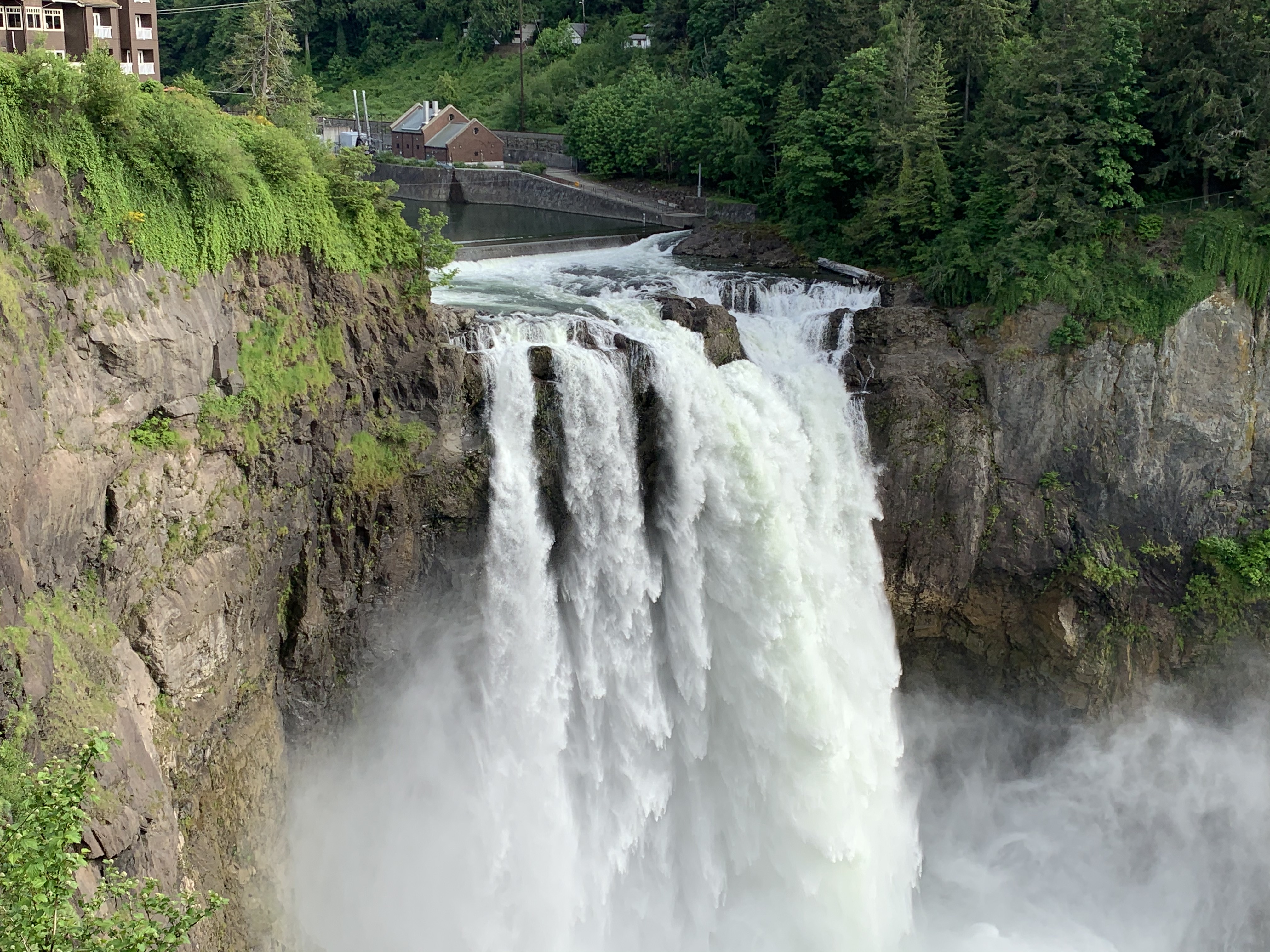
Snoqualmie Falls, on the Snoqualmie River in East King County. The falls has produced clean hydroelectric power for Western Washington since the early 1900s, and is a beautiful sight in all seasons.
Here’s the Link to Tina’s original post.

Beautiful choices for the week – loved the Mt Ranier image
And I didn’t include any of my cruise pictures, either. That would have tired out your scroll-finger.
Water around us gives sustenance in more ways than one.