
The State of Washington is divided by the North-South Cascade Mountains, a line of “extinct” volcanoes. The scare-quotes are real (see 1980’s eruption of Mount St. Helens). The climate (in more ways than one) of each half of the state is dramatically different. The Western half is known as the “wet” half, due to the Pacific Ocean and Puget Sound which provide ample moisture. That moisture is stopped by the high Cascades. Eastern Washington, on the other hand, is much flatter, drier, and the terrain is older.
Residents of each distinctive side of the state all say that their half is better. Well, “better” is a relative thing, and different people value different things. The majority of the population is found in Western Washington, as is the state capitol of Olympia. The big city of Seattle is in Western Washington, and its huge population pretty much dominates the state’s politics. Let’s explore both halves.
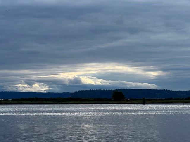
This is the view from the Waterfront Park in my city of Everett, looking West toward the Kitsap Peninsula on the West side of Puget Sound. Standard gray clouds.

This is the beach at the Dungeness Spit on the Olympic Peninsula in the far North-west corner of Washington. It faces the Straits of Juan de Fuca, an arm of the Pacific Ocean. If you watch long enough, you see big container vessels and oil tankers which ply the sea lanes. In Western Washington, you are never far from water. In most places, a lake or river is within a short drive of wherever you are.
 These are house-boats along the shore of Lake Union in Seattle. They are some of the more expensive dwellings in the city.


This is the body of water closest to where I live, Silver Lake.
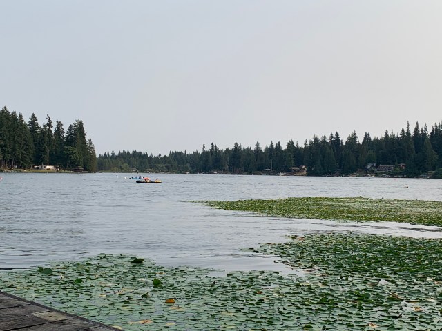
This is Flowing Lake, a park north and east of my house.
I said that the Cascade Mountains divide Washington in half. Below are a couple of photos from North Cascades National Park. It is only open less than half the year, since it is higher than the more-southern Cascades and it is too expensive to keep the roads plowed all year. However, a trip over the North Cascades Highway is a must-do in the summer.

This particular photo, on Highway 530 near Darrington, is very popular. The Washington Department of transportation uses a very similar photo on its Web site. You can see the North Cascades rising up behind the trees, and this is a very beautiful stretch of highway.
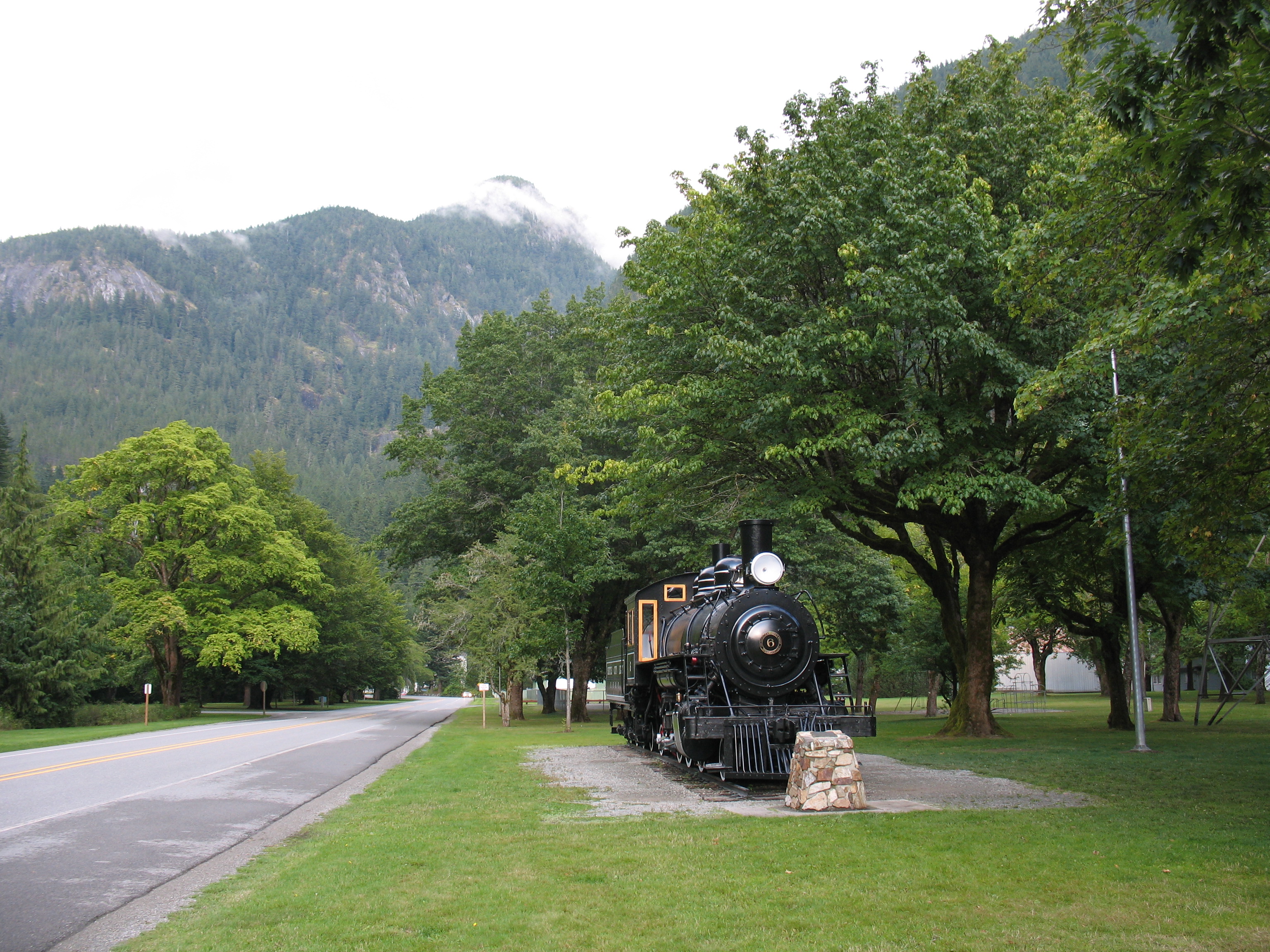
First stop: Town of Newhalem, where the kids love to play on the old locomotive which used to pull trains over the high pass, and carried the construction workers and materials to build the park and the railroad tracks.
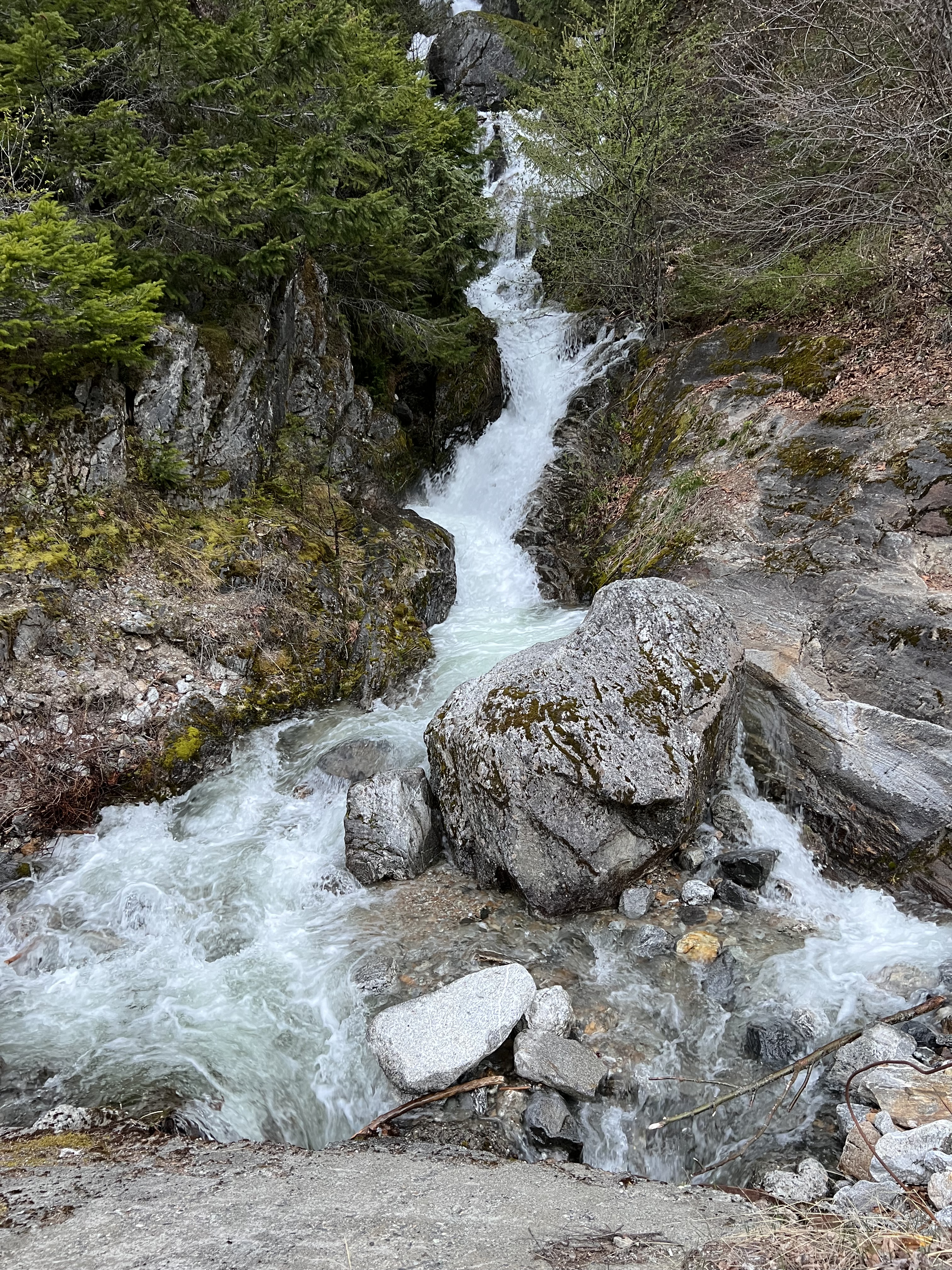
This little roadside waterfall is on US Highway 20 on the way to the park.
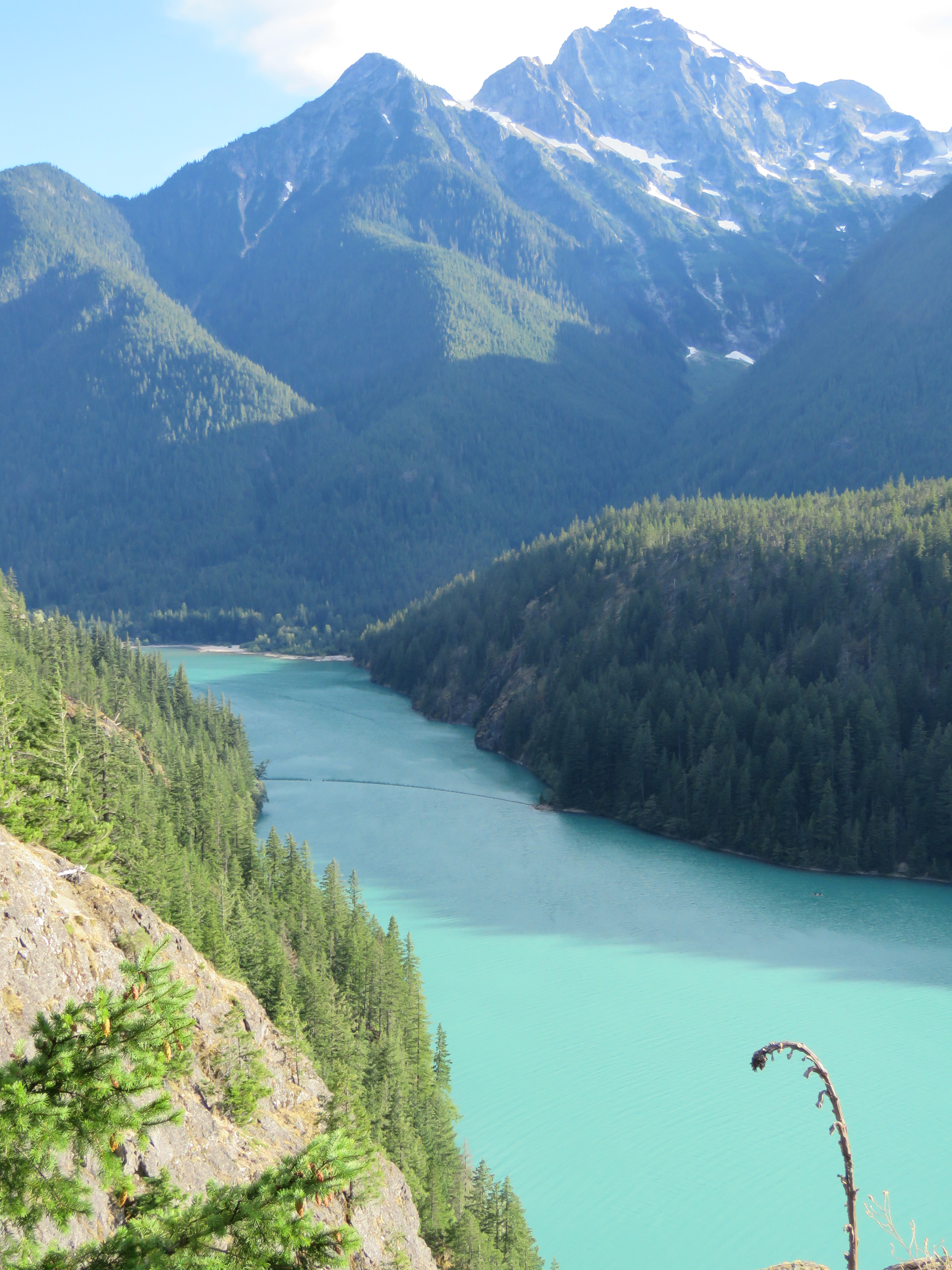
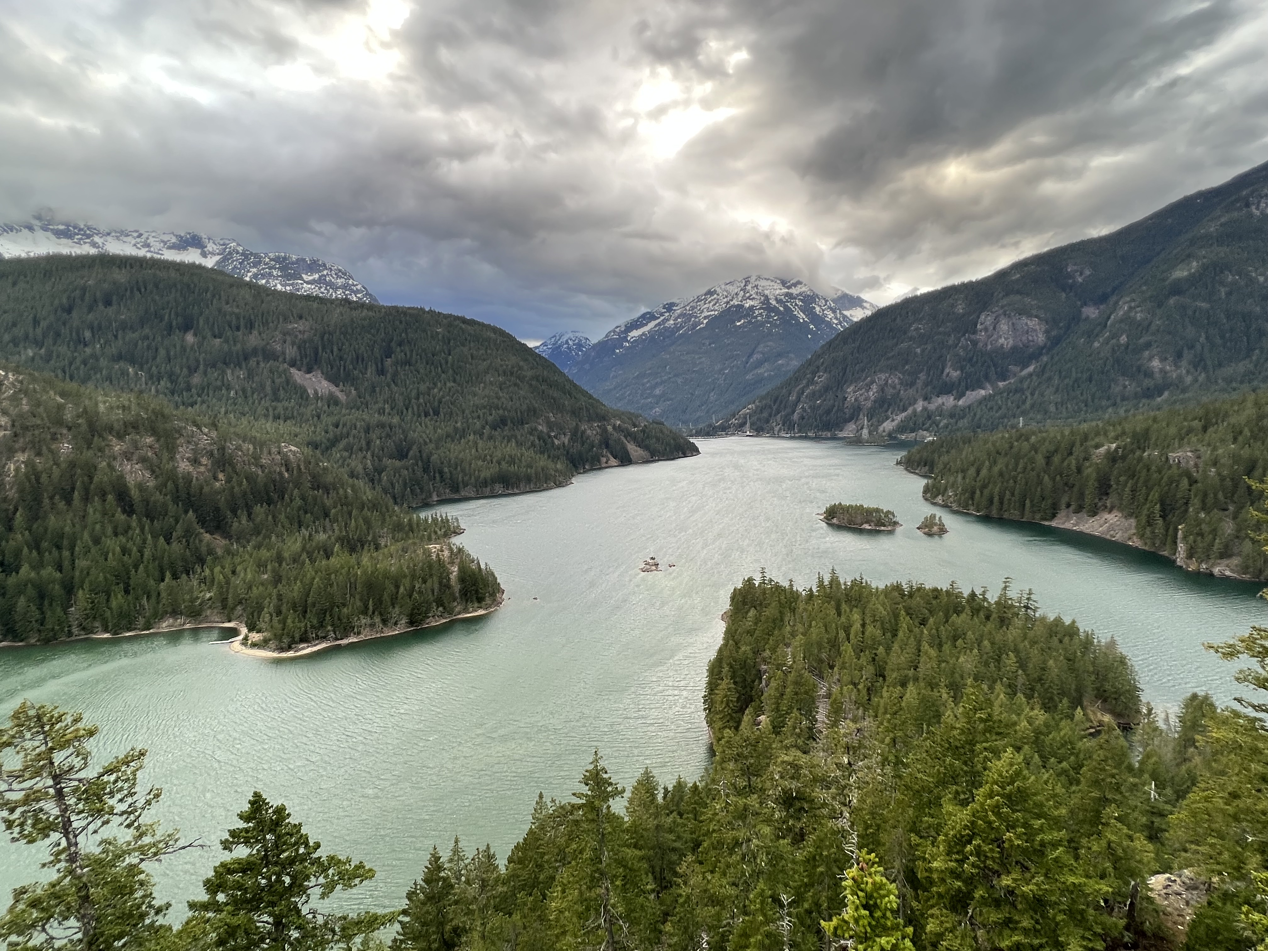
And this is Diablo Lake from the beautiful overlook about halfway up. This is one of our favorite places to go on a day trip. The lake is that distinctive blue-green color from glacial runoff.
Farther south in the Cascade Mountains, is Stevens Pass, on US Highway 2. There is a thriving ski resort at the top of the pass, and the scenery on the way is pretty spectacular.


The bottom photo is the ski area, and the top photo is on the east side of the pass, where you can see the avalanche tracks on the mountain.
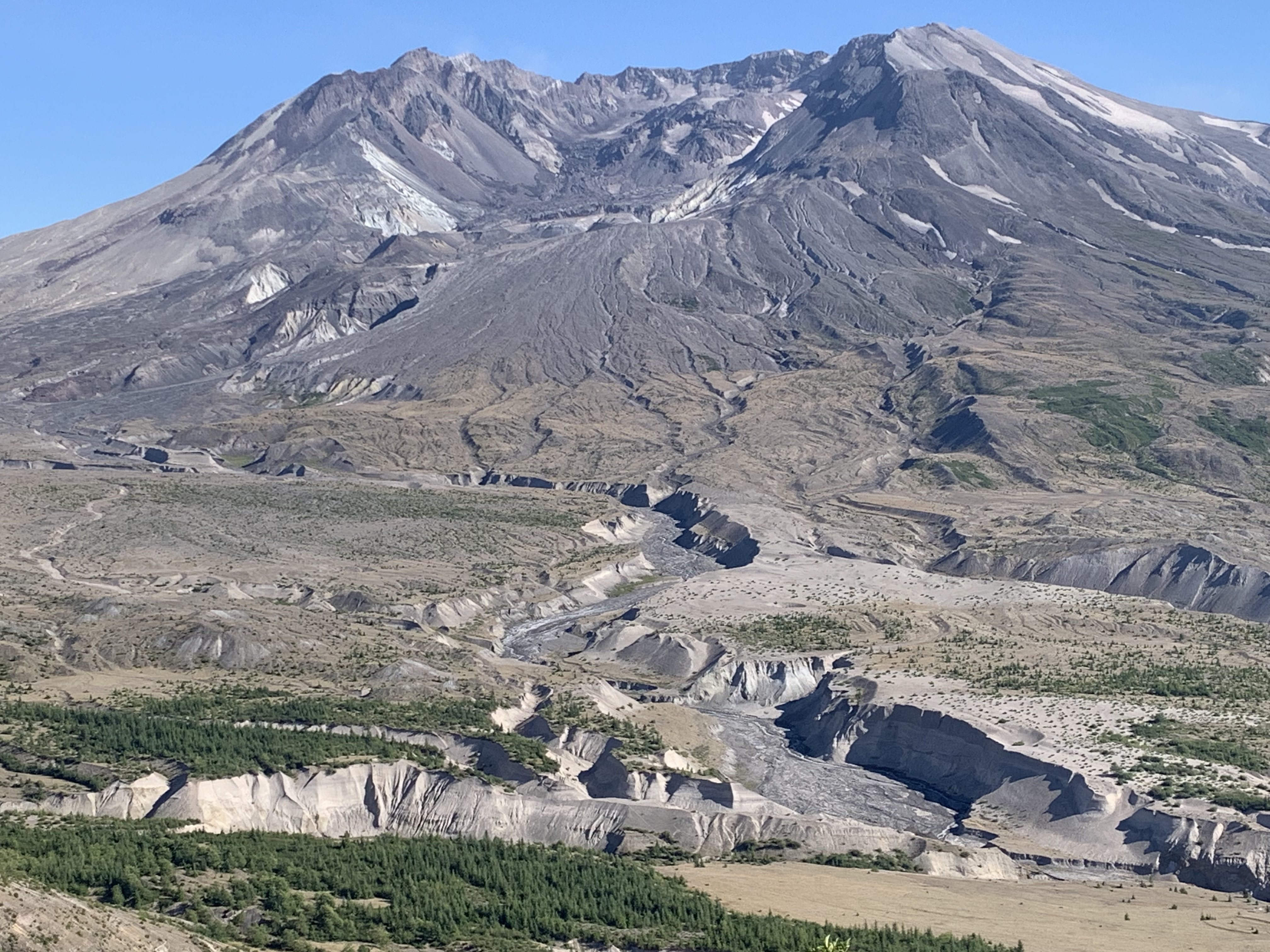
Farther south in the Cascade Range is Mount St Helens, or what is left of it after the eruption in 1980. It was a tall, snowy peak, until the eruption blew off half the summit, and spewed a plume of ash high into the sky. A couple of years ago, we took a day trip down there-the first time we had been there!

At least, this is what is left of the volcano. Here’s a different, closer view.
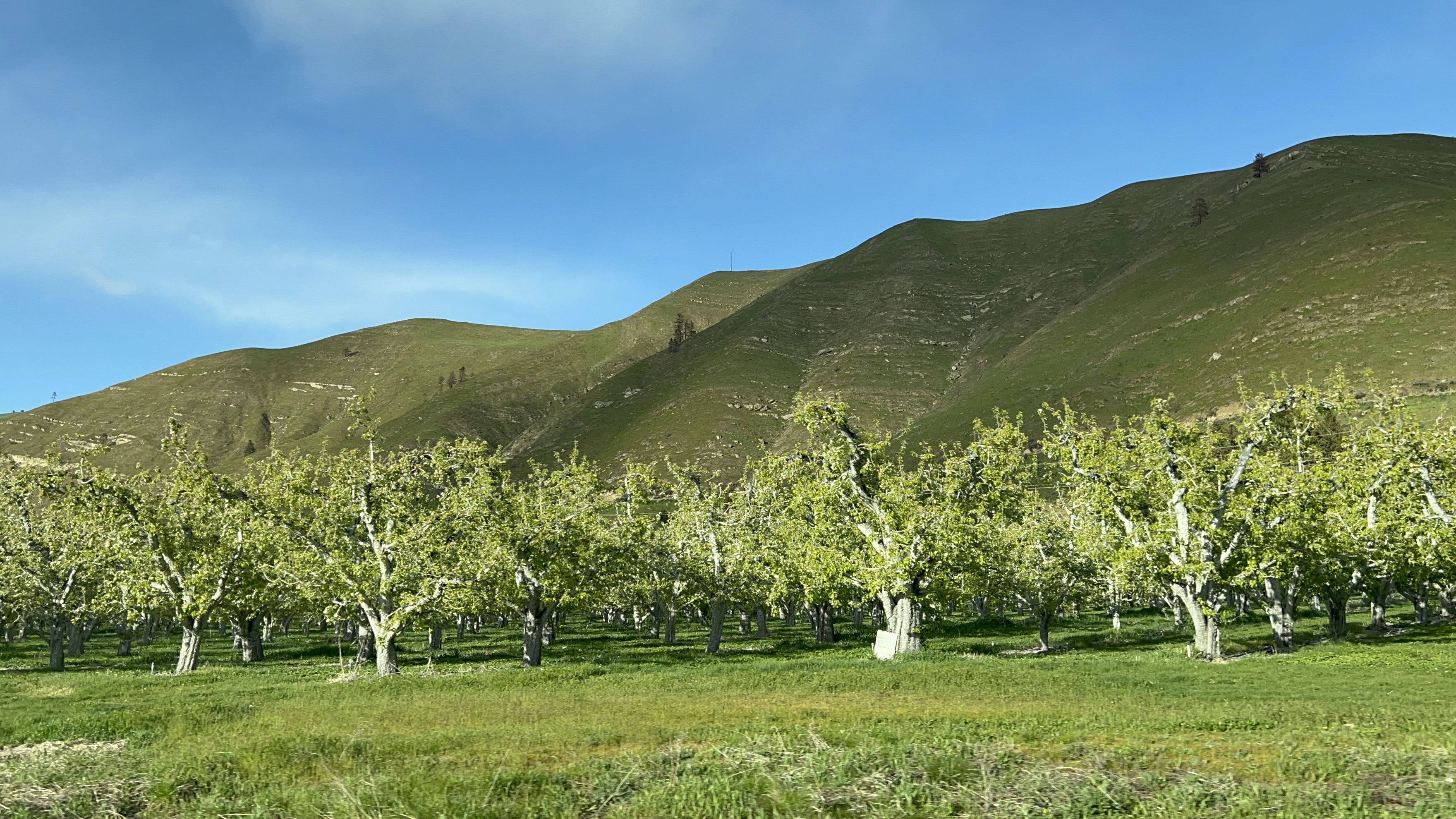
OK, now it’s time to cross the Cascades, and see what the landscape is like in Eastern Washington. Before we get there, though, we cross through Central Washington. Most of us have heard of the city of Wenatchee, known for its orchards and the Columbia River.
South along the Cascades is the Yakima Valley, known for its many wineries, and its own Viticultural Area. Vineyards are everywhere in the Valley.


Also a great sight is the Yakima River Canyon. The river is fairly shallow, and well-known for its fishing.

The hills along the river and all over the area are called “Shrub-Steppe Terrain”, and for some reason I just love that kind of landscape. Even though the hills are brown most of the year, I just love how they look.

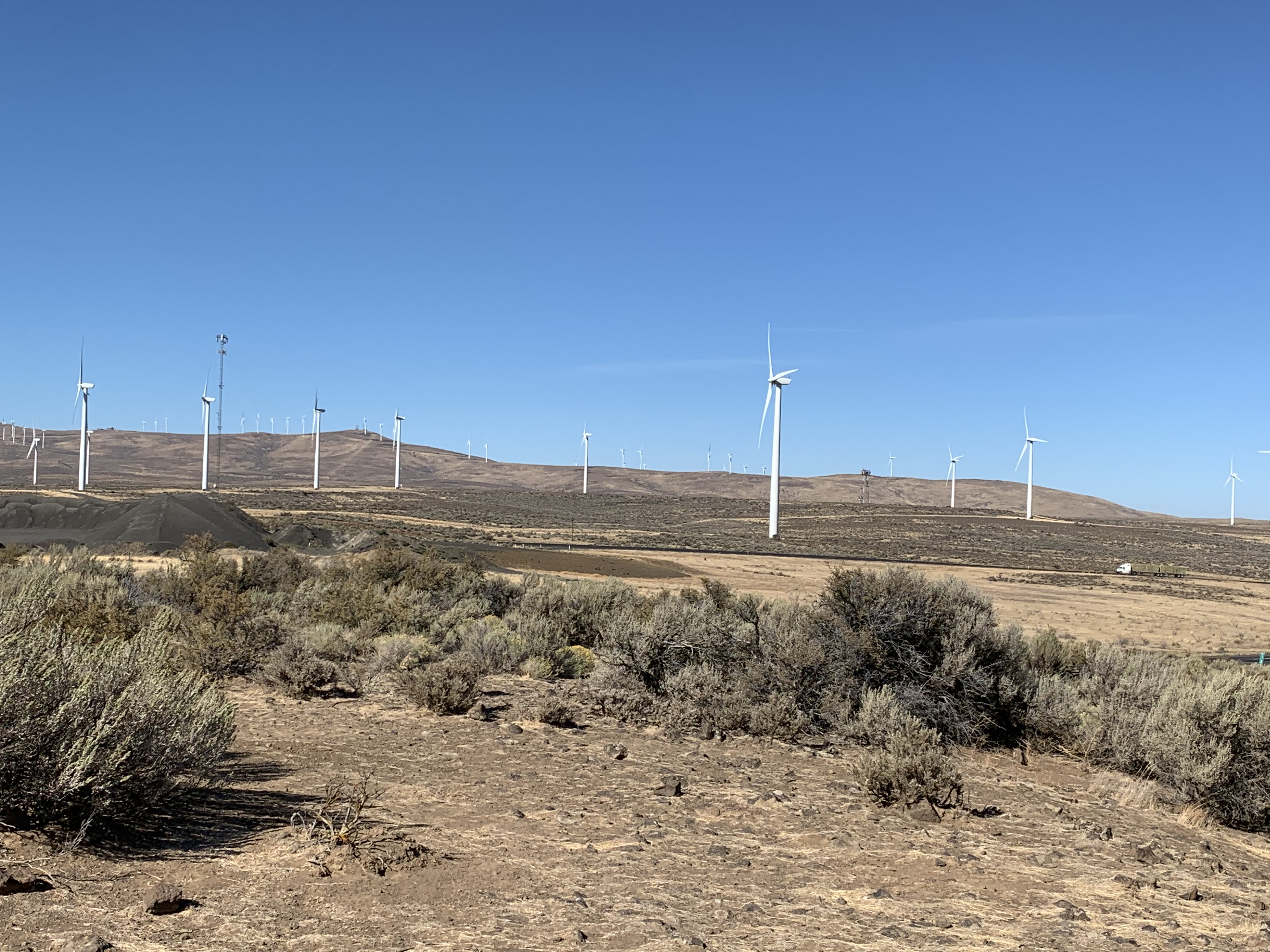
Drive East, and you come to the Mighty Columbia River, which drains, and provides power, to much of the Pacific Northwest, due to a number of dams along its length. Interstate 90 crosses the Columbia at the town of Vantage. Before you get there, you go through more of my favorite terrain (now marred, in my opinion, with huge wind turbines).
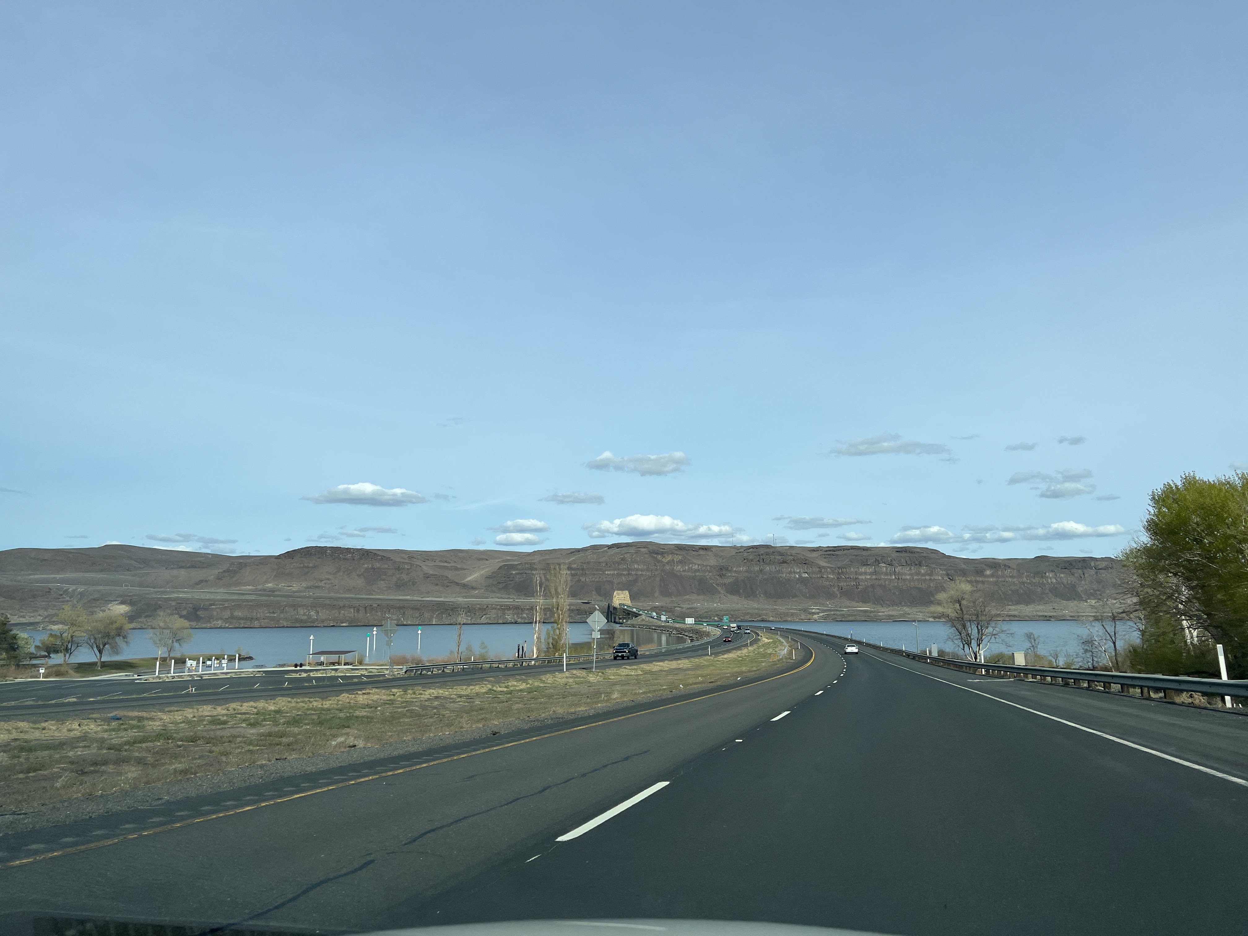
Once you cross the Mighty Columbia, you are in Eastern Washington. The highway climbs through the high cliffs, remarkable for their Columnar Basalt outcroppings. That basalt is the result of volcanic eruptions in prehistoric times.
Flat and rolling farmland is characteristic of Eastern Washington, and the farmers there grow many different crops, including corn, hay for animal feed, and wheat.


What would a trip to Eastern Washington be without a side jaunt to the Grand Coulee Dam?

The far East of Washington holds another great wine area, the Walla Walla Valley. We love to go there to sample wines at the many wineries, and drive the scenic roads.

Those are the Blue Mountains in the background.

And that’s our favorite winery in Walla Walla.
So, which half of Washington State did you like the best? Or are you like me, and love both sides! Each side has its benefits, and the entire state has climate and scenery for anyone.
